Travel Guide of Pikes Peak Highway in United States by Influencers and Travelers
The Pikes Peak Highway is a 19-mile toll road that runs from Cascade, Colorado to the summit of Pikes Peak in El Paso County, at an altitude of 14,115 feet.
Pictures and Stories of Pikes Peak Highway from Influencers
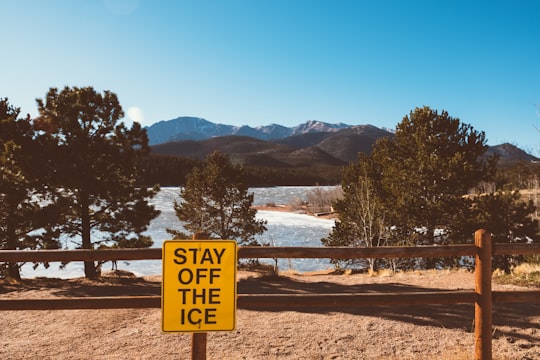
Picture from Andrew Seaman who have traveled to Pikes Peak Highway
Plan your trip in Pikes Peak Highway with AI 🤖 🗺
Roadtrips.ai is a AI powered trip planner that you can use to generate a customized trip itinerary for any destination in United States in just one clickJust write your activities preferences, budget and number of days travelling and our artificial intelligence will do the rest for you
👉 Use the AI Trip Planner
Book your Travel Experience at Pikes Peak Highway
Discover the best tours and activities around Pikes Peak Highway, United States and book your travel experience today with our booking partners
Map of Pikes Peak Highway
View Pikes Peak Highway on a map with the the closest popular places nearby
More Travel spots to explore around Pikes Peak Highway
Click on the pictures to learn more about the places and to get directions
Discover more travel spots to explore around Pikes Peak Highway
⛰️ Mountain range spotsWhere to Stay near Pikes Peak Highway
Discover the best hotels around Pikes Peak Highway, United States and book your stay today with our booking partner booking.com
Popular destinations near Pikes Peak Highway
Disover the best Instagram Spots around Pikes Peak Highway here
Mueller State Park
17 km (10.6 miles) away from Pikes Peak Highway
Travel guide of Mueller State Park